
We knew it was coming. It is here. A searing heatwave that is set to last until the weather breaks on Friday when rain and temperatures are expected to fall, though they will not plummet.
We complain enough about the cold. It was -10C outside my front door earlier this year. Now we have the opposite. It’s 28C outside the front door and my sun facing windows check in well above 30C on the outside. The pavement is 36C plus. It’s too hot to walk the dog. Double glazing keeps some of the heat out but as always it is a competition between air flow and heat flow.
The Met Office has issued a Level Three health alert. Most people know how to cope with a heat surge. But some older people and others who are vulnerable may not cope well. Just as in severely cold weather, it is helpful if people phone a friend or neighbour to see if they are coping well.
Advice from the NHS on coping with a heat wave.
From the Met Office.
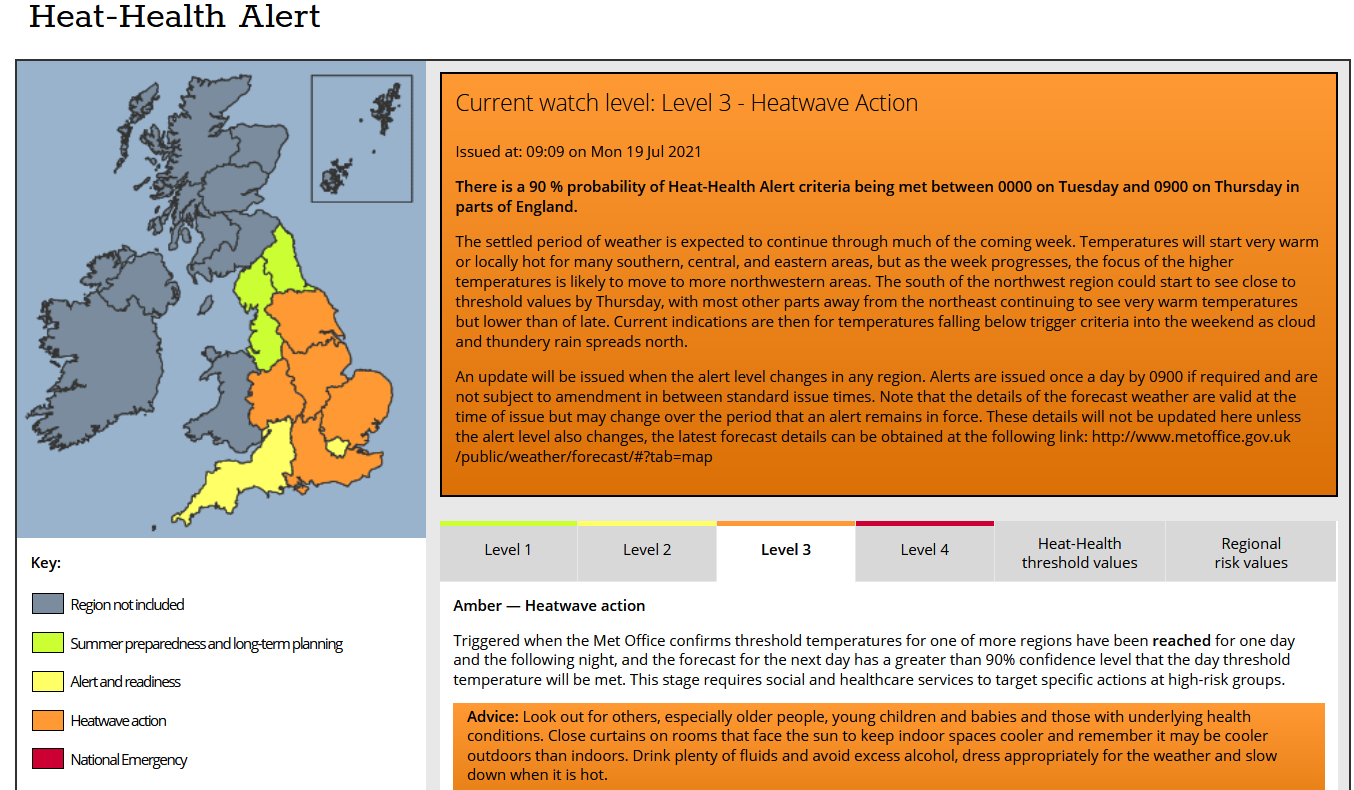
Heat-Health Alert
Level 3 – Heatwave Action
There is a 90 % probability of Heat-Health Alert criteria being met between 0000 on Tuesday and 0900 on Thursday in parts of England.
An update will be issued when the alert level changes in any region. Alerts are issued once a day by 0900 if required and are not subject to amendment in between standard issue times. Note that the details of the forecast weather are valid at the time of issue but may change over the period that an alert remains in force. These details will not be updated here unless the alert level also changes, the latest forecast details can be obtained here.
Regional Risk Assessments for occurrence of Heat-Health Alert criteria between 00:00 Local Time on Tuesday and 09:00 Local Time on Thursday.
The areas that are likely to be affected are:
|
Region |
Warning Level |
Risk |
Comments |
|
West Midlands/WM |
Level 3 (Amber) |
90% |
Daytime temperatures will be very warm or locally hot, followed by warm nights with maximum temperatures reaching 30 Celsius. |
General Comments
The settled period of weather is expected to continue through much of the coming week. Temperatures will start very warm or locally hot for many southern, central, and eastern areas, but as the week progresses, the focus of the higher temperatures is likely to move to more north-western areas. The south of the northwest region could start to see close to threshold values by Thursday, with most other parts away from the northeast continuing to see very warm temperatures but lower than of late. Current indications are then for temperatures falling below trigger criteria into the weekend as cloud and thundery rain spreads north.
