
It has been a very windy winter, with reports suggesting that 8 million trees have been blown down this winter so far. There will be a few more down by midday tomorrow, probably very many more.
There is an Amber Warning of high winds in Shropshire from 3am tomorrow until 9pm in the evening. The Met Office said today there is an increasing likelihood of widespread inland wind gusts of 60-70 mph and up to 80 mph in a few places. Around coasts of west Wales and southwest England, gusts of 90 or possibly even 100 mph are possible. Severe flood warnings are in place south of us. These areas have a Red Warning, which means a danger to life.
Ludlow Market is cancelled tomorrow and Transport for Wales has cancelled all train services including those through Ludlow. Buses might be cancelled at short notice. Power to homes and businesses could be lost. The general advice is do not travel.
Friday will be a good day to hibernate.
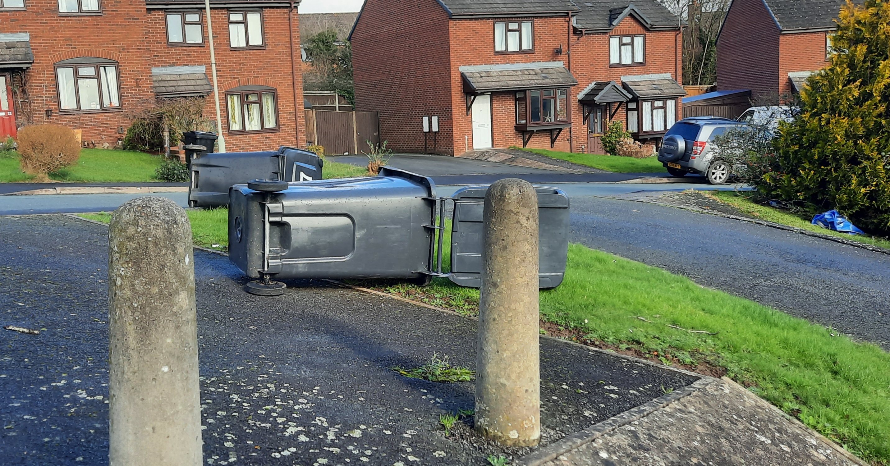
Could I suggest that people check their wheelie bins are taken in and secured? We had bins and boxes flying down streets during the somewhat milder Storm Dudley earlier this week.
An update from the Met Office is below.

Update from the Met Office via Shropshire Council’s Emergency Planning Unit.
Storm Eunice
Eunice is developing today to the west of Ireland and will push in across the UK during Friday. It has the potential to be a powerful and dangerous storm, possibly one of the most powerful in recent years.
Eunice will bring some heavy rain for a time on Thursday night and then strong winds during Friday. Wind speeds will be gusting in many places to 50-60mph at times on Friday and it’s possible if we are unlucky, we may see wind speeds touch 70mph or so at times too. These sorts of wind speeds are unusually strong inland, and if they were to be realised then we would see quite a bit of damage. We already saw some trees down yesterday from Storm Dudley, but winds from Eunice on Friday are potentially significantly stronger. When we have seen wind speeds of this level in other parts of the country recently we see widespread tree falls, instances of damage to buildings, roofs removed and HGV blowovers are possible.
Timing of Eunice means winds will begin to increase during Friday morning when they will blow from the Southwest, but then swing around to blow from the Northwest during the afternoon before easing down in the evening. This change in wind direction is also a potential mechanism for causing stress to trees and some buildings – increasing the potential for damage, and of course the worst of these winds will be happening in daylight when people are usually out and about.
Met Office have an Amber Strong wind warning in place for Friday for a Medium Likelihood of High Impact weather. We only issue warnings in this High Impact column on our matrix when we think the weather has potential to cause the most severe impacts and will bring a high demand onto responding agencies. It’s possible that as we receive more information today, we may be able to identify some areas where we are confident they will see the higher wind speeds, and so issue a Red warning for some areas. No decision has been made on that yet, and that decision is complicated by the fact that we have some evidence in a slight downward trend in the potential for the very highest wind speeds. Nevertheless – whether we issue Red Warnings or not Storm Eunice has potential to bring some extremely nasty, difficult and dangerous weather during daylight hours on Friday and will give many agencies a very busy day.
Weekend
Weekend weather looks poor at times, with rain (maybe a little snow on the hills) and some strong winds (although not nearly as bad as Eunice). If we do see a lot of damage on Friday then the poor weather across the weekend isn’t going to help those helping repair any damage. Of course, for those with interests along the rivers that drain off Wales and the Peak District in particular more rain will mean we continue to keep everything topped up and very wet.
